Met Office reveals nine regions expecting snow ahead of Tuesday – see the full list
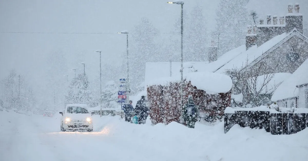
As the UK prepares for a spell of unsettled weather, the Met Office has flagged several English counties likely to see snow before Monday draws to a close. The focus is on the Pennines (the elevated range often called the “backbone of England”). While people are keeping an eye out for snow, attention is also on the wider possible effects on the country’s weather and the precautions that may be needed.
What to expect
Monday looks fairly quiet to begin with, though fog could disrupt the commute for many. That calm won’t last — a fresh frontal system sweeps in from the west, bringing rain to Northern Ireland and the western parts of Britain. The Met Office says that when this front meets colder air pushed in from the east across the northern half of the country, snow is likely on the leading edge over higher ground, including the Pennines and Scottish mountain ranges.
Counties specifically on alert for snow include:
- Northumberland
- Cumbria
- Durham
- Yorkshire
- Lancashire
- Greater Manchester
- Cheshire
- Derbyshire
- Staffordshire
Forecasters have noted similarities with late January 2014, and experts are using that historical data to warn about possible flooding risks.
What history shows and the forecast
Meteorologist Ian Simpson of Netweather remembers late January 2014, pointing to a strong Scandinavian blocking high (a high-pressure area over Scandinavia that can alter the usual winds) at the time. Rather than bringing cold easterly winds, lows from the North Atlantic were caught to the west and south-west of Britain. He says, “The winter quarter of 2013/14 was exceptionally wet for much of Britain, and it was snowy in the Scottish Highlands, leading to substantial snow patch survivals in 2014.” Those past patterns help put current developments into perspective.
The Met Office adds that Tuesday could see another deep area of low pressure approach the southwest of the UK, which might make it another wet and windy day for places already hit by storms this January. If that low tracks further south, the chance of severe weather for affected areas could be lower, giving some relief.
If the pattern continues
If the current pattern carries on through the rest of January and into February, conditions could get worse, especially for the west and south of Britain. These regions face a growing risk of flooding if the stormy weather seen in January persists. Ian Simpson warns that, without change, the pattern might bring even more severe weather as the weeks go on.
The Met Office is clear about the uncertainty at this range: “While at this range there is still some uncertainty, it is possible another deep area of low pressure could approach the southwest of the UK through Tuesday morning, bringing very wet and windy conditions to areas that have already suffered.”
As the country waits for potentially disruptive weather, it’s sensible to stay informed and be prepared. Keep an eye on updates from the Met Office and other reliable sources — understanding and preparing for possible effects is important for dealing with the unpredictability of UK weather.